
Deep Twin
A precise 3D site twin from drone & phone footage
Capture with an off-the-shelf drone and a 360° camera — the whole site becomes a connected 3D model in hours.
The problem
A usable 3D site model still demands ~$70,000 LiDAR
Survey-grade LiDAR: about USD 70,000, a day to capture, three-plus days to model. Too slow and too costly for sites that change daily.
Conventional (LiDAR) — hardware-heavy
- ~$70,000 LiDAR + specialist labor
- ~1 day capture + 3+ days modeling
- Too costly to re-scan often
Deep Twin — software, low-cost capture
- ~$700 drone + ~$400 360° camera
- ~1h capture · 3D model within hours
- Re-capture whenever the site changes
Inside Deep Twin
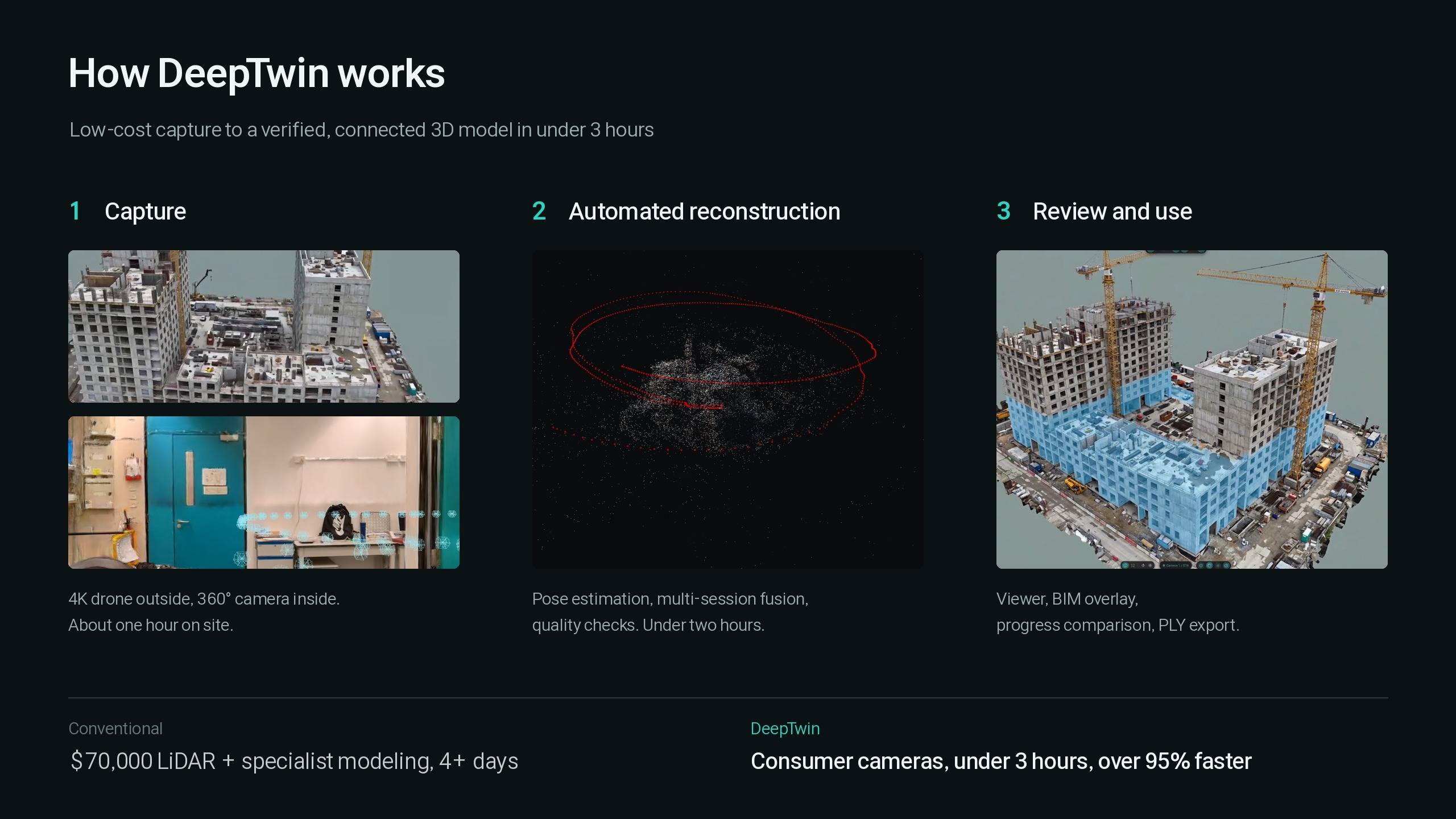
From footage to a connected 3D model — automatically
01
Guided capture with off-the-shelf gear
Exterior from a 4K drone, interior from a 360° camera. The software guides the capture and pulls the usable frames for you.
02
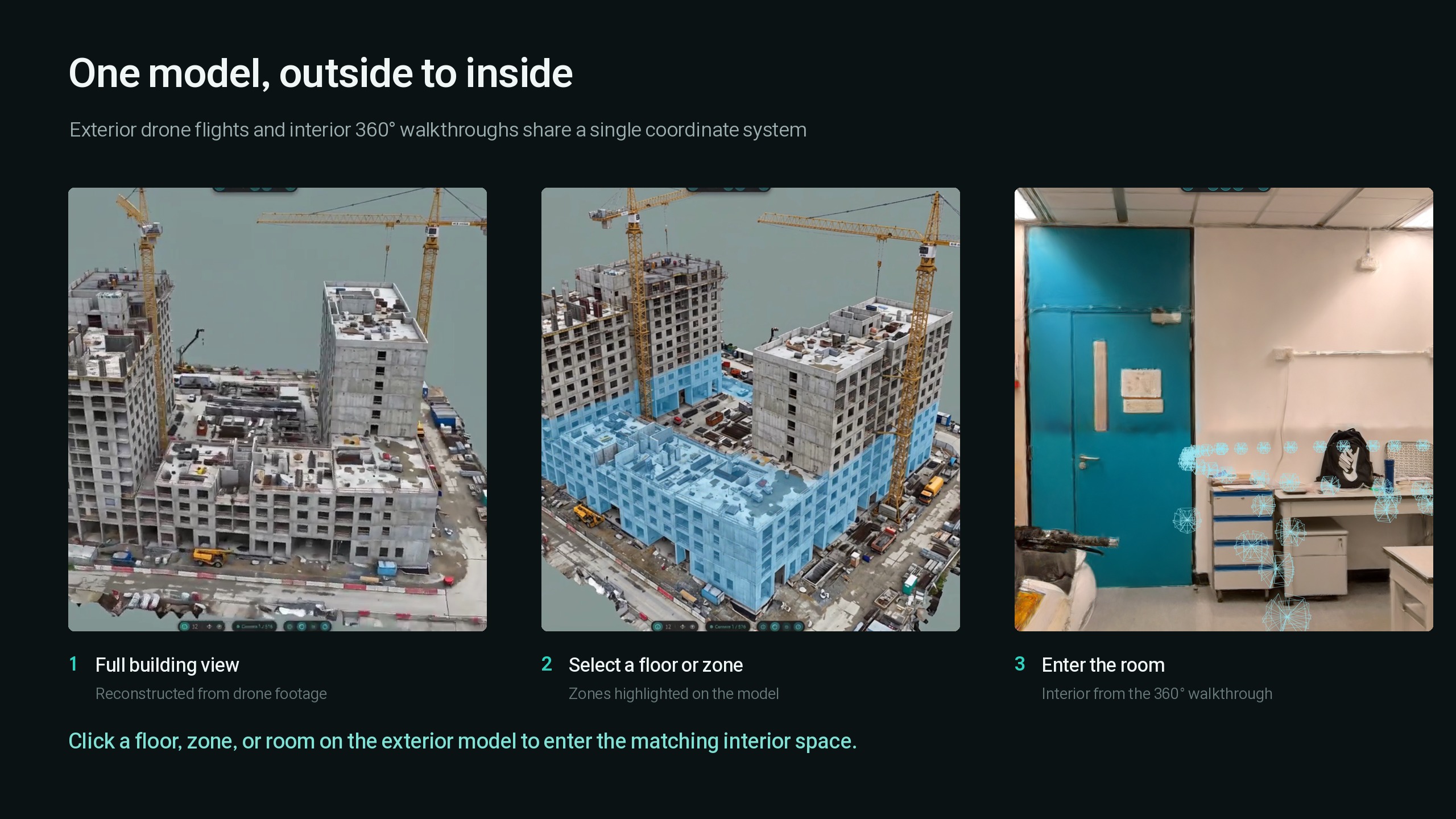
Footage in, a connected 3D model out
It estimates camera positions, aligns multiple sessions, merges exterior and interior, and reconstructs — with quality checks and cleanup, all automatic.
03
Segment, compare, measure, flag
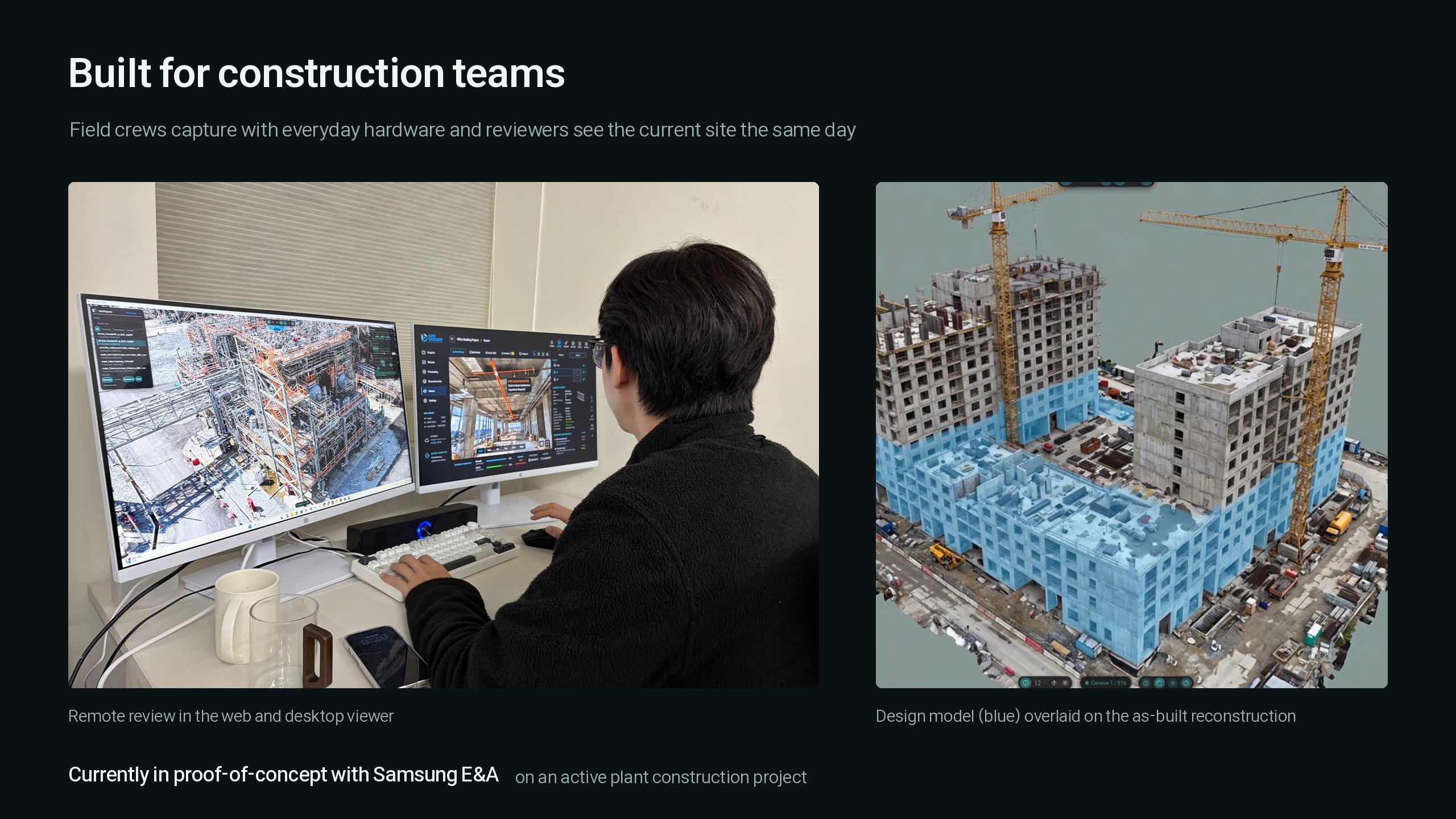
Segment individual pipes, overlay BIM or CAD, compare models captured on different dates, measure elements, and drop location-based issues and comments.
04
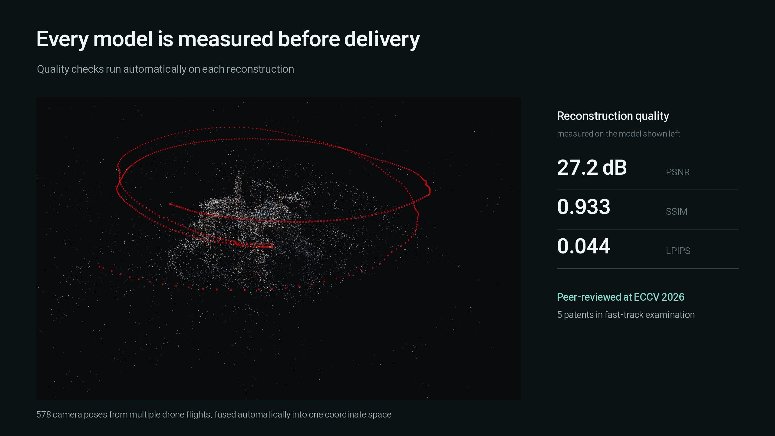
Every model is measured before delivery
Automatic quality checks run on each reconstruction. Peer-reviewed at ECCV 2026, with 5 patents in fast-track examination.
What it changes
The gear a site already has becomes a 3D twin
No LiDAR rig, no specialist modeling — a drone and a 360° camera plus automated software keep an as-built 3D record current.
capture to a connected 3D model
faster than the LiDAR workflow
LiDAR or manual modeling
the equipment cost vs LiDAR
Deep Twin is under active development. Cost and time figures reflect internal evaluation and vary with site size and complexity. No product certifications yet.
Start with the data you already have
Your existing data is the starting point for 3D. See it yourself with a demo.